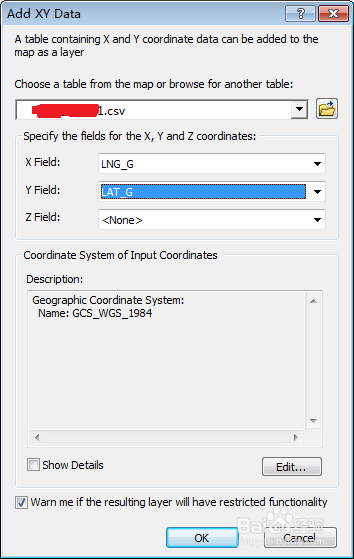
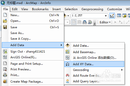
1、点数据转化为Acrgis的点要素,在ArcMap里,
File ——Add data ——Add xy data;坐标系统选择Geographic Coordinate System:Name: GCS_WGS_1984
2、要素转为shape,点击刚才生成的图层,右键选择data——export data ——转化为shape文件
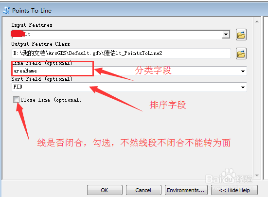
3、点转面,选择ArcToolbox定位到data mangement tools ——Features——points to line,注意分类字段(哪些点是一条曲线上的)和排序字段(一条曲线上 的点的顺序)
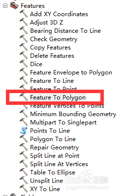
4、线要素转面要素,选择ArcToolbox定位到data mangement tools ——Features——Feature to ploygon

